Giveaways
ON the 6th of March, 2025, I joined some friends from a local fishing club on a trip to Pigeon Island, one of three islands near the head of Lake Wakatipu.

Pigeon Island is also known as Wāwāhi Waka, the place of splitting wood for canoes. At the turn of the twentieth century, an ethnologist named James Cowan recorded many South Island Māori placenames and their origin stories, otherwise on the verge of being lost to memory in a landscape that had become overwhelmingly Pākehā.
According to Cowan,
A memory of the vanished tribe Ngatimamoe is contained in the name “Wawahi-waka,” which is that of an island in the upper part of Lake Wakatipu, called by the Europeans “Pigeon Island.” “Wawahi-waka” means “splitting canoes”; it owes its origins to the ancient Ngatimamoe, and other people of the Stone age, who resorted here to fell and split up trees for the purpose of canoe-making. Totara pines of large size formerly grew on this island, now almost treeless.
Tōtara, which normally grow in lush rainforests, thrived because the islands in Lake Wakatipu have a milder climate than the subalpine landscape around the lake.
The land around the lake mostly has tussock and southern beech trees, which are useless for woodworking, in its valleys, and no trees at all in the more exposed parts.
Here’s a photo of the spot we started from at the edge of the lake, with some small trees right on the waterline and barren hills behind.

Here’s another boat heading out to Pigeon Island, which is just on the right, with the low-lying Pig Island, or Mātau to the left.

It was a chilly morning. Thank goodness the sun was up by the time we got to the island.

Luckily, the native bush has grown back since Cowan’s time, thanks in a big part to volunteers who have been replanting the islands (now a pest-free nature reserve).

There are a couple of huts on the island, the biggest one being the Pigeon Island Hut, which has a ton of old-school character.


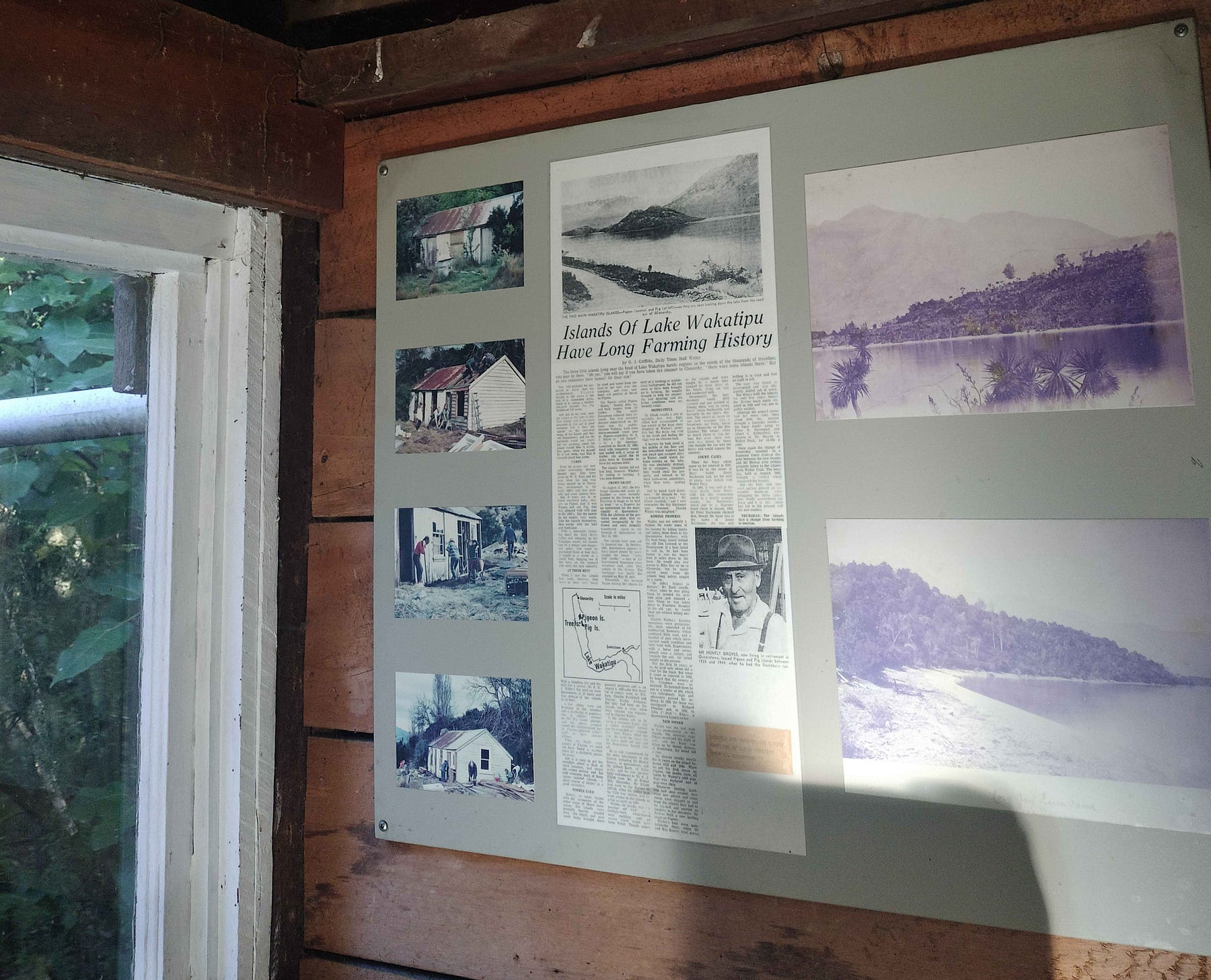
On the wall, there was a copy of an old newspaper article about the islands of Lake Wakatipu.
We then headed out on one of the island’s tracks, to the summit, which is 463 m above sea level, meaning that it is some 150 m (500 feet) above the lake. You can see the summit in this photo taken from the boat just before it landed.


As you can see, the views are fantastic.

They include the view down onto Pig Island/Mātau, and the tiniest of the islands, Tree Island. This photograph gives perhaps the clearest view of how the islands are a sort of oasis of greenery compared to their surroundings.

After we got back, I went for a swim in the pure but chilly waters of the lake.

There were 20 or 30 of us who went over, in all. A lot of the people who do the volunteer work on Pigeon Island are quite elderly, but young people are coming to the fore. And the morning chorus of birdsong is quite loud. There are lots of different species of birds, including the flightless weka, one of which came strolling along the beach while I was there.
Here is a video I made of the boat trip to the island, the inside of the Pigeon Island Hut, the summit, and the boat trip back. The boat trips were fast and exciting in their own right!
Note: The passage from Cowan was from a lecture called ‘Maori Place-names: with Special Reference to the Great Lakes and Mountains of the South Island,’ published in the Transactions of the Royal Society of New Zealand, Vol. 38, with the note that it was “Read before the Wellington Philosophical Society, 4th October, 1905.”
There’s more about this part of the country in one of my books, The Sensational South Island, on sale on this website a-maverick.com.


Subscribe to our mailing list to receive free giveaways!
